Hill classifications and the people behind the lists

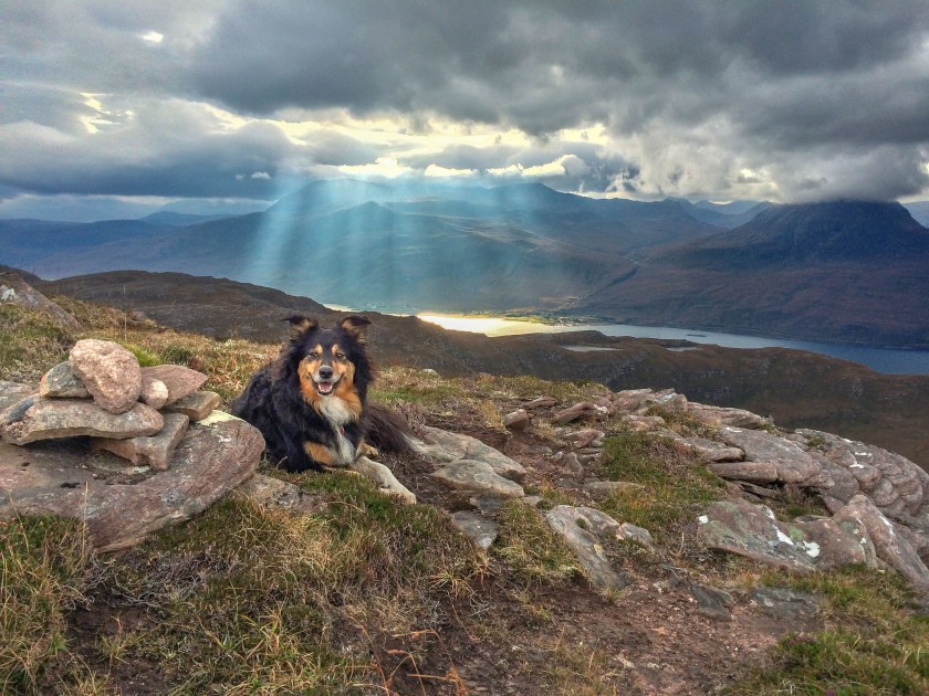
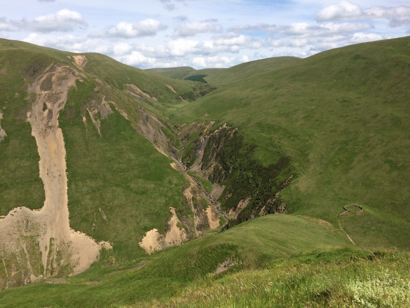
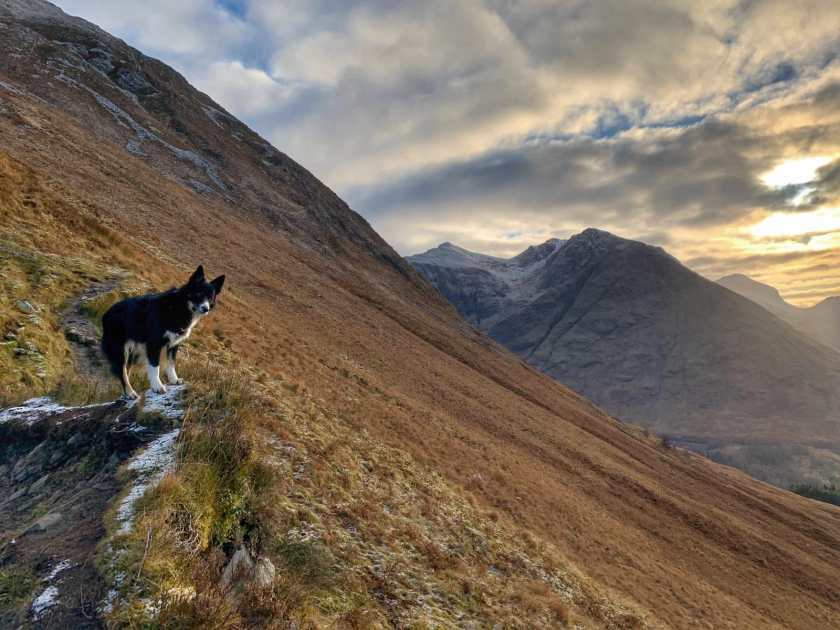
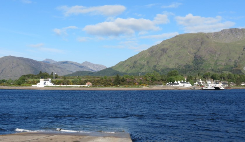
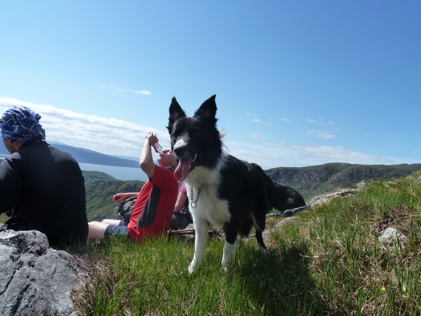
‘What is a hill? More specifically-what makes a hill worth climbing?

A hill slopes upwards. Many of them are very good at that.

A hill has a view (if only the mist would clear).

A hill is something distinct.’

Eric Yeaman

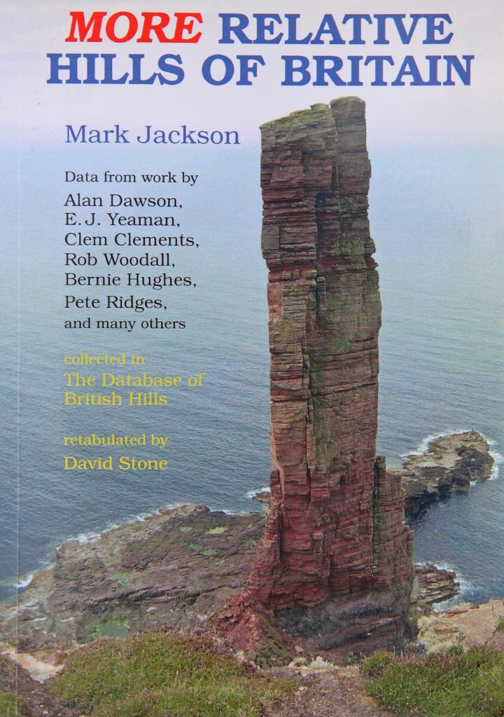
The listing of hills falls broadly into three main categories. Traditional or eponymous lists are named after their founder, the person who compiled the list, such as Munros and Wainwrights. Relative lists, such as Marilyns and Simms are prominence based, hills are classified based on their relative height in comparison to the surrounding terrain as opposed to their height above sea level. Hills such as Corbetts and Grahams are a combination of the two, they are named after their founder(s) but also have a relative height definition.

Munros and Munro Tops

Munros are Scottish mountains over 3000 ft/914.4m in height. A Munro Top is a subsidiary top of a Munro, also over 3000ft/914.4m.

A’ Mhaighdean, the remotest Munro

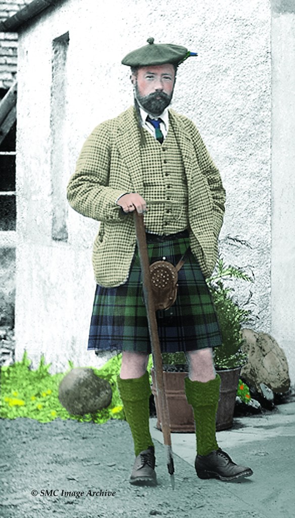
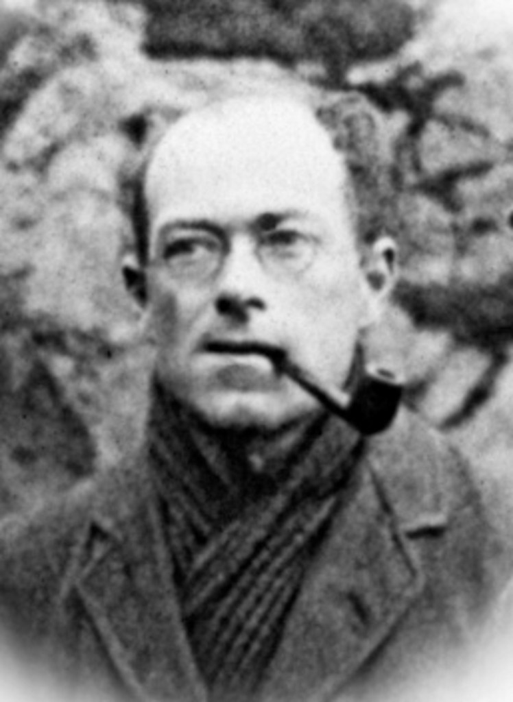
Munros are named after Sir Hugh Munro, who was a founder member of the Scottish Mountaineering Club (SMC), eventually becoming the club’s third President in 1894.

Munro was born in Eaton Place, London in 1856 and was educated at home in Worthing and Charmouth. After an early diplomatic and military career, he settled down to run the family estate of Lindertis near Kirriemuir. He was well travelled, making trips to Europe, Asia, North America and Africa. Although not renowned for his technical climbing ability, Munro was an enthusiastic hillwalker, undertaking long expeditions into the hills, often in winter. His first recorded ascent of a 3000ft mountain was on Ben Lawers in 1879.

Sir Hugh Munro. (SMC Image Archive)

In 1891 Sir Hugh Munro was asked by the SMC to list the mountains in Scotland over 3000ft. His ‘Tables, giving all the Scottish mountains exceeding 3000ft in height’, were first published in SMC Journal No. 6 in 1891. The list comprised 538 hills; 283 separate mountains (Munros) and 255 subsidiary Tops, outliers to the main summits, but still felt by Munro to have significant topographical merit and therefore worthy of inclusion. The list became known as ‘Munro’s Tables’. Munro did not define any objective criteria for classifying Munros and Tops and this has lead to lots of debate over the years. In his notes he wrote ‘the decision as to what are to be considered distinct and separate mountains and what may be counted as Tops, although arrived at after careful consideration, cannot be finally insisted upon’.

Munro regarded the Tables as a single list and was aiming to climb them all prior to his death.

Munro’s Tables, 1891

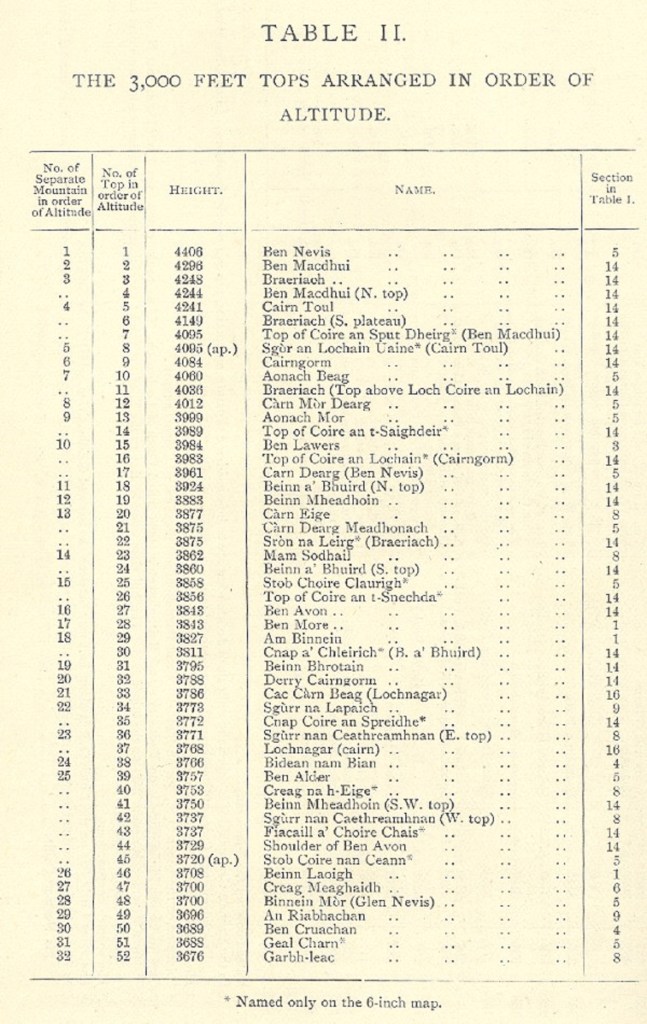
Munro’s Tables are divided into 17 sections based on the natural geography of the Highlands. Munro used Ordnance Survey one-inch to the mile maps, these only showed 250ft contour intervals and six-inch to the mile maps, which showed spot heights but did not include contours. The maps were often inaccurate and incomplete. He also utilised Admiralty charts and an aneroid barometer to measure summit heights. Over the next 20 years Munro worked to refine his list, constantly rechecking data and redefining summits and this tradition has continued, with the list of Munros and Tops being revised in 1921 (based largely on Munro’s own refinements) and again in 1974, 1981, 1984 and 1997. The 1974 edition of Munros Tables was the first to be published in metric units when 3000ft became 914.4m.

Munro’s Tables, Section 1

Munro did not manage to climb all the hills on his list. He died on 19th March 1919 at Tarascon, France, during the post-war influenza epidemic whilst running a canteen for Allied forces. He died with three summits still unclimbed.

Ben Nevis, 1344m, the highest Munro

In 1901 the Rev. A. E Robertson became the first person known to have climbed all the Munros, famously kissing the cairn and then his wife, after reaching the summit cairn on Meall Dearg in Glencoe. Robertson sums up the period of 10 years he spent climbing the Munros as, ‘I look back upon the days I have spent in pursuing this quest as among the best spent days of my life’, a sentiment many a modern Munro bagger will relate to.

Another cleric, the Rev. A. R. G Burn, followed in 1923 becoming the second person to climb the Munros and the first to climb the Munro Tops. Mrs Paddy Hirst became the first woman to complete the Munros in 1947.

During the early part of the 20th century hillwalking was the preserve of the professional or privileged classes. Munro and his contemporaries often walked at night to avoid disturbing stalking or grouse shooting activities. Early pioneers such as Munro, Robertson and Burn walked exceptional distances, often on multi-day, cross country trips. They stopped overnight with families living in remote glens and relied heavily on the goodwill of Highland folk to put them up and feed them. They made extensive use of the rail network and mail buses and Robertson sometimes used a bicycle to reach remote hills.

On the Stob a’ Choire Odhair ridge, Ladhar Bheinn

When a person has climbed the 282 Munro summits listed in Munro’s Tables they are said to have ‘completed’ or ‘compleated’ the Munros. A person who has completed the Munros is known as a Munroist and the SMC maintain a list of all those who register their completion. Between 1960 and 1971, Eric Maxwell began to compile a list of people known to have climbed the Munros (Munroists) and Munro Tops (Toppers). Maxwell stated that it was ‘important to make some distinction between the Munroists and the Toppers. It is clear that the Topper does about twice as much as the Munroist and sees twice as much. In some cases, such as An Teallach, he gains immeasurably, and although a few Tops are admittedly as dull as ditchwater, he gathers a much more detailed knowledge of the hills and at the same time has much more enjoyment’. An argument, if ever one was needed, that climbing the Tops as well as the Munros is a worthwhile undertaking.

Maxwell’s list in the SMC Journal, 1960

Maxwell’s list was originally published in the Grampian Club Bulletin and the SMC took over management of the list once the number of registered Munroists reached 100. The list of completers is available on the SMC website Scottish Mountaineering Club (smc.org.uk)

The list of Munros is maintained by the Scottish Mountaineering Club and following a recent flurry of surveying activity, the total now stands at 282 Munros and 226 Tops.

Corbetts

John Rooke Corbett compiled his eponymous list during the 1920s.

A Corbett is defined as a hill between 2500ft/762m and 3000ft/914.4m in height with a drop of at least 500ft/152.4m between each hill and any adjacent higher one. Although Corbett himself didn’t specify this criterion, it was inferred latterly by John Dow.

Beinn Dearg Mor from Shenavall

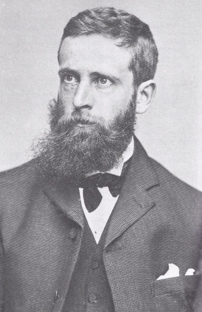
Corbett was born in 1877, he worked as a district valuer in Bristol and was a founder member of The Rucksack Club. He was a member of the SMC and in 1930 he became the fourth person, and first Englishman, to complete the Munros. Corbett’s list was not published until after his death, when his sister passed the list on to the SMC. In 1939 John Rooke Corbett became the first person to have climbed all the hills on his list and was therefore, the first recorded Corbetteer.

Corbett also listed hills in England and Wales, but since its adoption by the SMC, the Corbetts are regarded as a Scottish list.

John Rooke Corbett. SMC Image Archive

The designated drop between each Corbett makes them a much more clearly defined list than Munros and ensures that they are quite distinct hills. The list has changed over the years as a result of resurveying by the Ordnance Survey and The Munro Society and now contains 222 Corbetts.

Loch Hourn from Buidhe Bheinn

It is wrong to think of Corbetts as ‘lesser’ hills, giving shorter or easier walks than the Munros, many walks are long, remote and over pathless demanding terrain. The drop criterion means that there are very few instances where three or four can be combined in long traverses as is the case with Munros.

Grahams

A Graham is a hill between 2000ft/609.6m and 2500ft/762m with a drop of 150m or more on all sides. The list was updated by Alan Dawson 2022 and now includes 231 hills between 1968ft/600m and 2500ft/762m.
The list was first published by Alan Dawson in ‘The Relative Hills of Britain’ in 1992. Fiona Torbet (nee Graham) also published a similar list later in 1992, she compiled the list whilst recovering in hospital after a skiing accident.  Torbet’s list had a vague definition, it contained a defined drop criterion of 150m or the highest point for ‘about two miles’ and did not include any hills south of the Highland boundary fault. The two lists were combined, refined and defined by Torbet and Dawson and became known as the Grahams.

Suilven, an iconic Assynt Graham

Alan Dawson was born in Liverpool and didn’t start climbing mountains until he was in his 30’s as there was no history of hillwalking in his family. Dawson trained as a cartographer with the Ordnance Survey where he drew plenty of maps of hills but didn’t actually climb any.

After finding books on the Welsh 3000ft mountains, the 2000ft hills of England and Wales and the Munros, Dawson started to use a database to store lists, dates and notes and states that ‘bagging gave purpose to my life, offering the highest highs and the lowest lows, with an unpredictability that was both pleasing and infuriating’. As he started studying hill lists more closely, Dawson began to find anomalies and omissions and realised that there was scope for improving the existing lists and began to work on a new type of hill list based on relative heights which would eventually become the Marilyns.

Alan Dawson surveying on Gurlet North Top

Fiona Torbet was a trained musician, a keen sailor, hillwalker and environmental campaigner. In 1993 Fiona Torbet went missing whilst on a hillwalking holiday in Kintail and her body was found a year later. She had been murdered by the owner’s son whilst staying in their B&B and was buried in the garden.

After Torbet and Dawson combined and rationalised their separate lists they became known as the Grahams (Fiona Torbet’s maiden name was Graham. Alan Dawson felt that having a list of Corbetts and Torbets would prove rather confusing). The official Grahams list is maintained by Alan Dawson and there are currently 231 hills on the Graham list.

Stac Pollaidh,612m

The majority of Grahams do not have defined paths and the highly vegetated terrain can be particularly challenging, it is unusual to meet other walkers on most of the Grahams and the lower elevation often provides some of the best views of their larger neighbours.

Donalds

Percy Donald’s regional list of ‘Tables Giving All Hills in the Scottish Lowlands 2000ft in Height or Above’ was first published in the SMC journal in 1935. Whilst compiling the Tables, Donald climbed every hill in the Scottish Lowlands over 2000ft/609.6m during a 5 month period beginning in December 1932. He used mainly public transport and walked alone, climbing all the hills wearing a kilt.

Percy Donald. SMC Image Archive

Donald worked as an engineer in Edinburgh, Egypt, and Dumbarton and joined the SMC in 1922 where he served as Slide Custodian for 4 years, during this time he labelled each slide and catalogued the whole collection. Percy Donald died whilst hillwalking alone in the hills, he was found drowned in a pool below the Eas nam Bealach waterfall on the Allt Coralan in the hills south-east of Auch. S.M.C. Vice-President Sandy Harrison’s obituary for Donald contained the elegant insult ‘few people who dealt with him could have remained indifferent to him’.

Percy Donald’s death notice in the Dundee Evening Telegraph, Sept 1938

Donald’s Tables are set out in a similar way to Munro’s Tables with summits classified as Donalds or Donald Tops and lists 141 summits, 89 Donalds and 52 Donald Tops.

Donald developed a cumbersome and complex formula to distinguish between which summits he classified as Hills and those he considered Tops.

Donalds formula: Tops are all elevations with a drop of 100ft/30.48m on all sides and elevations of sufficient topographical merit with a drop of between 100ft/30.48m and 50ft/15.24m on all sides. Grouping of Tops into Hills, except where inapplicable on topographical grounds, is on the basis that Tops are no more than 17 units from the main top of the hill to which they belong; where a unit is either one twelfth of a mile measured along the connecting ridge or on 50ft contour between the lower Top and its connecting col.

Donalds. Glen Sax, from the sublime……………….
……………………………………….to the ridiculous, Lowther Hill

Donalds Tables are seen as a complete entity and since 2018 people climbing a round of Donalds must climb all 141 hills on the list.

Furths

The Furths are the 3000ft/914.4m mountains in the British Isles ‘furth’ of (further of, or outside) Scotland.

Snowdonia, home to the Welsh Furths

The first list of Furths was published by James A. Parker in the SMC Journal in 1929. Parker called the hills ‘The British Threes’ and listed 4 English, 12 Welsh and 7 Irish hills in his list.

Parker’s list of ‘The Bristish Three’s. SMC Journal, 1929

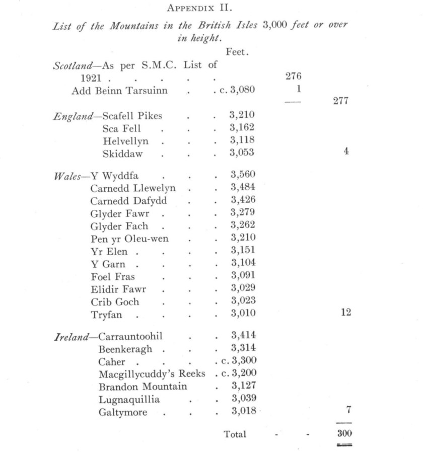
The term Furth was first used by Eric Maxwell in the Grampian Club Bulletin in his article ‘Furth of Scotland’, published in 1959. Maxwell persuaded his son David to produce the first formal listing of the Furths and his ‘Tables giving all the 3000ft Mountains of England, Wales and Ireland’ were published privately in 1959. Maxwell’s list contained 11 Irish, 7 English and 14 Welsh summits.

The first recorded Furthist was J.A Parker who completed the Munros in 1927 followed by the Furths in 1929.

Cantilever Stone, Glyder Fach

The Furths list is maintained by the Scottish Mountaineering Club and now contains 34 summits; 6 in England, 15 in Wales and 13 in Ireland.

Full House

A Full House is the term used by the Scottish Mountaineering Club for completing rounds of the Munros, Munro Tops, Corbetts, Grahams, Donalds and Furths.

A Full House

Marilyns

A Marilyn is a hill of any height with a drop (relative height or prominence) of 150m on all sides, regardless of distance, absolute height or topographical merit.

The list of Marilyns within Britain and Isle of Man was compiled by Alan Dawson and was published in the book ‘Relative Hills of Britain’ in 1992.

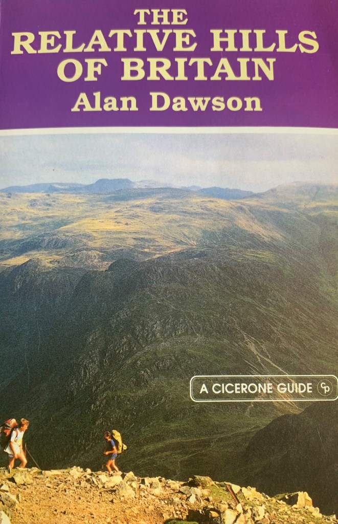
Alan Dawson set out to compile a list of all summits in Great Britain, regardless of elevation, with the sole criterion for inclusion being a drop of 150m/500ft on all sides and created a metric, prominence based list. Dawson believed that in Great Britain a drop of 150m/550ft was proportionate to the size of the hills and ‘felt right’. He appreciated the precise definition of Corbett’s list more than the vagueness of the Munros and Tops, so he used a similar definition for relative height to that used by Corbett.

Mullach an Eilein, Boreray, St. Kilda. Micahel Earnshaw/Geograph

The list of Marilyns is maintained by Alan Dawson and there are currently 1556 hills on the list. The list contains all the Corbetts and Grahams plus 202 Munros, therefore, as almost 50% of Marilyns are over 2000ft/609.6m, they should not be regarded as lower hills.

Eleven people are known to have climbed all the Marilyns on the official list. Rob Woodall became the first person to complete the Marilyns when he climbed the remote sea stacks of Stac an Armin and Stac Lee on St. Kilda in 2014, followed the same day by Eddie Dealtry.

Simms

A Simm is a ‘Six-hundred Metre Mountain’ in the Britain. To qualify as a Simm a hill must be over 600m in height with a drop of at least 30m on all sides.

The list was introduced by Alan Dawson in 2010 as a means to consolidate several other relative hill lists which he regarded as complicated and outdated (Murdos, Hewitts, Corbett Tops and Graham Tops).

The list is maintained by Alan Dawson and contains a total of 2530 hills.

HuMPs

A HuMP is a Hundred Metre Prominence, a hill of any height within Britain, the Isle of Man and the Channel Islands with a drop of at least 100m on all sides.

The concept of HuMPs had been around for 20 years before Mark Jackson produced the official list of HuMPs in 2007. Compiling the list was a considerable undertaking as Jackson identified new summits and amalgamated existing lists of hills which fulfilled the 100m drop criterion.

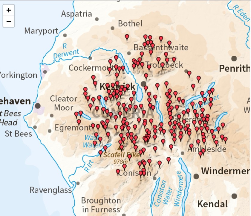
There are currently 2982 hills on the HuMPs list, including the sea stack known as the Old Man of Hoy. By the end of 2020, only two people had climbed all the Humps: Rob Woodall and Alan Whatley.

TuMPs

A TuMP is a Thirty and Upward Metre Prominence, a hill of any height in Britain with 30m of drop on all sides. The current list includes over 17,000 hills and now represents the greatest challenge for the hillwalker. The list was devised by Mark Jackson in 2009 following three years of research, drawing on the work of many others, including Clem Clements, Myrddyn Phillips, Alan Dawson, Eric Yeaman and Rob Woodall. The list is still being revised as more accurate data becomes available and new hills are created, following the restoration and revegetation of large waste tips in former mining areas. Numerous Tumps are sea stacks that are almost impossible to land on and climb, and it is quite possible that some will never be climbed. Public access to certain Tumps is forbidden for reasons of national security or their location on private property.

Wainwrights

Regional lists cover hills in a specific area, many of these are personal or arbitrary listings and are not topographically defined. By far the most popular of the regional lists is the Wainwrights of the Lake District.

These summits were never intended by the author to be a hill list, but the 214 hills described in Wainwright’s books have become regarded as a list by generations of hillwalkers.

Nuttalls

Nuttalls are hills in England and in Wales over 2000ft with a relative height of at least 50ft/15m. The list was compiled and published by John and Anne Nuttall, and is still being refined following extensive research work by their son Joe Nuttall, as well as surveying work by Myrddyn Phillips and G&J Surveys. There are currently 443 Nuttalls and numerous people have completed the list as the Nuttalls are an ideal target for hillwalkers living in England or Wales.

Despite not having a list named after them, two people stand out in the categorisation of hills but remain relatively unnoticed.

William McKnight Docharty

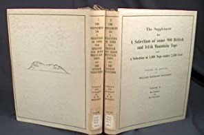
In 1954 Docharty published a list of all the hills between 2,500ft and 3,000ft in Great Britain. His list, titled ‘A Selection of some 900 British and Irish Mountain Tops’ was privately published and still remains relatively obscure even to this day. The list was subclassified into ‘Independent Mountains’ and ‘Tops’ and also included a list of the 3,000ft hills in England, Wales and Ireland.

A second volume included 1,022 hills between 2,00ft and 2,500ft was published in 1962. This list includes the hills now known as Grahams and Donalds. Being privately published and mainly given to his close friends, Docharty’s work is not widely available and does not have the notoriety or influence that it deserves.

After recovering from injuries received in World War One, Docharty rediscovered an interest in the hills of home and began to explore his native Scotland. After completing the Munros and Tops in 1948 he began compiling a list of 2500ft/762m hills in Scotland. Over a period of 30 years, he visited all the summits on his lists and documented the climbs within each volume. The list contained over 900 hills, including what we now know as Corbetts and all the 3000ft/914.4.m hills in England, Wales and Ireland. Docharty did not drive and relied on friends, bicycle or public transport to travel to and from the hills.

Professor Matthew Forster Heddle

Prof. Heddle, one of Scotland’s leading mineralogists, spent 50 years exploring the Highlands and Islands of Scotland to determine the location of every mineral in the country. During his work Heddle developed a consummate knowledge of the hills and landscapes of the Highlands. By 1891, seven months before Sir Hugh Munro published his list, Heddle announced to the St. Andrews Philosophical Society that there were 409 mountains in Scotland above 3000ft (which he called 3000ers) and he had already managed to climb 350 of them. After Heddle’s death in 1897, Munro wrote that ‘there can be little doubt that Prof. Heddle had climbed far more Scottish mountains than any man who has yet lived’.

Heddle was responsible for naming Ben Loyal the ‘Queen of Scottish mountains’ and one the tops on its castellated summit ridge is known as Heddle’s Peak.

Ben Loyal from the Kyle of Tongue. Sarah Charlesworth/Geograph

Heddle did not publish his list but was busy compiling it even before Sir Hugh Munro was born. As a young man Munro met and admired Heddle, who later provided him with some aneroid measurements for his Tables. It is probable that Heddle passed his list on to Munro to help with the compilation of his list.

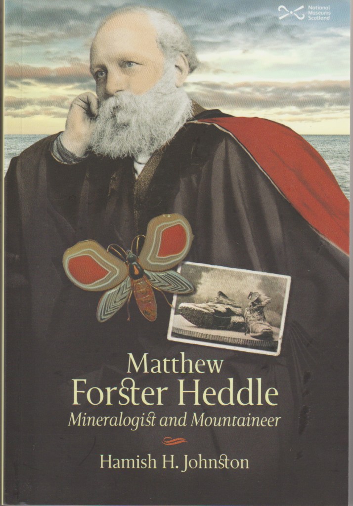
Unfortunately Heddle’s list is lost, but if Heddle had completed his list before Munro, we would all be busy Heddle bagging an would have become Heddleists rather than Munroists.

So, if all these lists aren’t enough to keep even the most obsessive bagger busy there are plenty of other lists; Dodds, Highland Fives, Hewitts, Nuttalls, Wainwrights, Birketts, County Tops, Dillons, Arderins, SiBs and Synges.

And if you want to go overseas there are Ultras (summits with a prominence of over 1500m). So many lists, so little time.

Details of all hill lists and summit grid references can be found at www.hills-database.co.uk

Last gasp In Fisherfield

Beinn a’ Chlaidheimh – 916m
Sgurr Ban – 989m
Mullach Coire Mhic Fhearchair – 1018m
Beinn Tarsuinn – 937m
Date: 21st August 2012
Weather: Warm and sunny
Two Feet Four Paws: Anne, Stewart and Molly

Anyone who has completed a round of Munros will know that planning plays a vital part in reaching that goal. I am usually quite good at planning, so how was it, with a mere six days to go until my 4th Round completion party I found myself with the four Mullardoch Munros and four of the Fisherfield Six left to climb?

Things hit a major hurdle when Stewart and I arrived at the locked gate in Glen Strathfarrar on Sunday morning aiming for a swift round of the Mullardoch Four from the end of the glen. Booting up in the carpark Stewart realised he has managed to bring two identical left boots with him rather than a pair! Thankfully disaster was averted when a couple parked next to us offered to loan Stewart a pair of boots for the day and the walk was saved. After a successful walk over the four Munros, only incurring minor wrath from the gatekeeper for being 5 minutes late the Weather Gods at MWIS indicated that there would be a small weather window on Tuesday for our visit to Fisherfield. Stewart was keen to join the trip and promised to bring the correct configuration of boots this time.

Continue reading “Last gasp In Fisherfield”

The Grahams: A journey I never intended to take

On 15th September 2018, accompanied by over 50 friends, I stood on the summit of Fiarach, my final Graham. How the bloody hell did that happen? I am a Munro bagger and there I was having climbed all 219 Grahams (a Graham is a Scottish hill between 609.6m and 762m with a drop of a least 150m on all sides).

Guard of honour approaching Fiarach

Years ago, Robin and I had started to use the derogatory term DG’s as a tongue in cheek term to describe the ‘Dull Grahams’. Like the majority of my hill walking friends, I still had my Munro blinkers firmly in-situ and was not ready to be converted to the joys of spending hours trudging over bogs and ploughing through thigh deep heather just to reach the summit of a mere ‘DG.’ Even a cursory glance at hill walking websites showed a distinct lack of interest.

The seldom ascended Meall a’ Chaorainn

There is a plethora of route descriptions, photos and trip reports on every Munro and there is even a growing interest in Corbett bagging. There are guidebooks aplenty, but the Grahams remained overlooked, they seem to be a poorly loved relation that very few would actually admit to climbing!

Molly on Beinn Ghoblach

There was a guidebook, Andrew Dempster’s 1997 publication ‘The Grahams’, but it wasn’t exactly an inspiring tome, text heavy with a few black and white line drawings thrown in for good measure but nothing that would make a keen hillwalker want go out and actually climb them. The book does have its uses, it is ideal for getting the bothy fire going and the pages are thick, strong and thoroughly absorbent! (Since I started climbing Grahams the SMC have published their new hillwalkers guide to ‘The Grahams’, I wonder if this will tempt people away from bagging the far more popular Munros?)

Views from the Grahams. Creag Dubh Mhor above Attadale

Most hillwalkers can probably name hundreds of Munros, they may have even climbed a handful of Corbetts, but how many even know what a Graham is? A few of my hillwalking friends were busy climbing Grahams and a few had even completed a round of them. Me, I just chose to ignore them!

Staggering back to Oban Bothy after climbing Meith Behinn

I had already completed 5 rounds of Munros and round 6 was reaching its closing stages, the Corbetts had been completed in 2010 and I was busy banking Munros for round 7, but I was getting bored, Munro bagging was beginning to lose its appeal and I needed a new challenge.

Carn Gorm above Glen Cannich

I have always found that one of the most enjoyable aspects of hillwalking is the planning involved with each walk and repetitively climbing the same Munros again and again didn’t exactly involve a lot of planning, just a lot of determination.

Beinn Alligin from Beinn na h-Eaglaise

Then, during the autumn of 2014 Molly started limping. Molly was extraordinary, she never tired of being out on the hill, she completed her own Corbett round in 2012 and climbed 1227 Munros. Her limp started off rather insidiously, coming and going over a couple of weeks. After a visit to the vets Molly was diagnosed with bicipital tenosynovitis (shoulder tendonitis to you and I), restricted exercise was prescribed until the limp resolved itself and in the end, it turned out to be a very long winter! Thankfully after 4 ½ months of veterinary physiotherapy and a slow steady increase in exercise, Molly was ready to get back on the hills. After all that time off, we were both pretty unfit and needed some shorter and easier days to break us back in and the Grahams of the eastern Cairngorms fitted the bill perfectly. These hills have a reputation for being rather unremarkable, and indeed they were! It was fantastic to be back in the hills again and the big Cairngorm skies helped to rejuvenate my enthusiasm to go out and bag something. We had to be very careful not to do too much too soon so we continued to travel further afield and climb more of the easier Grahams. After a couple of months I updated my hill logger and realised I had already summitted over 30 Grahams!

Molly on Creag Ghuanach

During all our time off I had been chatting away to David Batty who was already well into the final stages of his own Graham round and he was always very clear about what a great set of hills the Grahams were, under-rated, virtually deserted and pretty challenging. I didn’t really need much more encouragement, my passion for the hills had been rekindled and I felt excited at the prospect of climbing lots of new hills and visiting different areas, plus of course, all those delightful hours of planning, something that I was sorely missing during my previous years of Munro OCD.

Glen Elchaig from Carnan Cruithneachd

We visited lots of new places. I am embarrassed to admit that I had never been to the Ochils and had driven past the Luss hills numerous times when we lived in Helensburgh without giving them a second glance. Graham induced visits to Caithness and the accompanying views to Orkney from the summits of Morven and Scaraben will live long in my memory and I will always associate their isolated summits with an overriding sense of space and freedom.

Beinn a’ Mhuinidh in Torridon which translates as ‘hill of pissing’!

I am sure that if I hadn’t decided to complete the Grahams these areas would remain unvisited to this day. My previous trip to the Outer Hebrides had resembled a ram raid, all that way just to climb Clisham. A slightly longer visit to the Grahams on South Uist and Harris in 2016 whetted my appetite but further exploration was needed and I was very pleased to revisit not just Clisham and the 4 island Grahams again in 2019 but to also explore many of the hidden Hebridean gems that I had simply driven past on previous visits.

Ralph on Uisgneabhal Mor, Harris

I have only met people on a handful of Grahams so they are ideal for the anti-social hill walker. Of course, there are popular Grahams, with Stac Pollaidh and Suilven being the standout hills in Assynt irrespective of their classification. Bill, Molly and I first visited Stac Pollaidh in 2009 and we had done absolutely no research on how hard the route was. During the morning we climbed the Corbett Breabag and from the summit cairn we looked across to Stac Pollaidh and decided to go and climb it that afternoon. We reached the ridge and Bill became unhappy with the exposure, so I left him sitting with Molly and my rucksack and went out to the summit by myself. I looked at the final climb to the summit and realised that there was no way I was going to get up there on my own. I turned around and almost walked into two blokes heading up to the summit, I told them I couldn’t make it to the top and they replied, ‘we’ll get you up there no problem’ and true to their word, they did. I have no idea who they were and I was so relieved to get down in one piece I didn’t ask their names, but I am forever indebted to them for helping me get up and down safely.

Spring skies in Cowal

We climbed Suilven on a stunning spring day and it lived up to its reputation as one of the most spectacular mountains in the country, I am just not sure why it took me 18 years to climb it.

On the ridge, Suliven

We were in full bagging mode when Molly started to slow down. Nothing unusual as she was 9 ½ and becoming very grey around the muzzle. A trip to the vet revealed devastating news; Molly had kidney failure. She did not respond to treatment and died at home 7 weeks later in her favourite chair. Ben Stack at the end of June 2016 was the last hill we climbed together.

Molly on Ben Stack

Life without a dog was hard and hillwalking without a canine companion seemed very lonely, so a few weeks after Molly died Ralph joined the family. He is a Border Collie from a working farm in Dunkeld and he spent the early months of his life learning recall, how to negotiate his way through a boulder field involved several visits to the Chalamain Gap and how not to fall into bogs (which he did, a lot). We gently built up his stamina taking care not to strain his joints and most importantly he learnt not to chase wildlife or livestock on the hills.

The very easy Graham Carn na-h Easgain near Tomatin was Ralph’s first hill. We climbed those unremarkable eastern Grahams all over again and we travelled north, south and west to pick up some of the more straightforward ones that I hadn’t already climbed with Molly.

Approaching Beinn Talaidh on Mull

During Ralph’s first year on the hill we spent a lot of time down in the Borders and Galloway. I had made the decision to climb the Donalds as well and planned my routes to maximise the number of hills climbed on each walk and reduce the number of trips away from home.

Ralph on Lamachan Hill above Loch Trool

Some of these walks, earlier dismissed as a means to an end were a revelation. Maybe I was lucky in that I climbed a lot in August when the heather was in full flower. Beforehand, I would never have thought that the Glen Sax round near Peebles (Dun Rig and 3 Donalds) would go down as one of my Top 10 most memorable hill walks.

Above Glen Sax

Likewise, the circuit of Loch Enoch to Craignaw and Mullwarchar, over some of the most heinous terrain I have ever had the misfortune to walk across, still lives in my mind, not for the tortuously slow progress through the thigh deep undergrowth but for the remote lochs, birdsong and endless views.

Loch Neldricken on our way to Mullwharchar

I wonder how many Munro baggers have experienced the solitude Ettrick Head? A place you have to put some effort in to get to in the first place and where you will find yourself surrounded by steep sided heathery hills.

The depths of Ettrick Head

The flipside of this was two car linear walk with Frank and Mark over Windy Standard and its accompanying Donalds. We did seriously question our sanity having spent 8 hours on the hill in low cloud and drizzle and where the only features of note were wind turbines, bulldozed tracks, cairns, trig points and endless miles of squelchy bog.

Carn Breac in the Coulin Forest

At the start of 2018 I was left with only 35 Grahams left to climb before completion. That doesn’t sound too bad but they were possibly the 35 hardest to do. Some logistically challenging, particularly when you live in Aviemore, trips to Mull, Aran and Jura were needed and somehow all the remote ones had been left to last on the list. In fact, when I showed David Batty my list of remaining hills he laughed!

An Stac above Loch Morar

An Cruachan, Croit Beinn, Beinn Gaire, Meall Garbh, Beinn a’ Chaisgein Beag, Beinn nan Lus, the Mam Hael group, Mullach Coire nan Geur-oirean, Slat Bheinn and Meall nan Eun, Ben Armine and Stob Mhic Bheathain were all still unclimbed.

On Meith Bheinn

These names will mean nothing to the vast majority of people reading this but they will send shudders down the spine of those busy bagging the Grahams. All of them are remote, all of them are very long days out and the terrain is typical of the Grahams over miles of pathless bog, tussocks and heather. Only 10 days out but those 10 days amounted to 300km and 11,000m of ascent.

Incongruous artwork on the way to Beinn a’ Chasgein Beag

I am lucky that living in Aviemore meant that most of my remaining hills were day trippable from home so I was able save them for decent days and the weather during the late spring and summer of 2018 was generally kind. I left Ralph at home with Bill and travelled to Caithness for the long bike and hike to Ben Armine, with the daffodils and lambs lining the Strath of Kildonan invigorating me for the long 52km day ahead.

Ben Armine, it’s a long way from anywhere

We took the boat to Barrisdale Bay for the energy sapping climb up Slat Bheinn and Meall nan Eun and it was the first time I have ever thought I would have to abandon my route due to the heat, despite the fur coat Ralph seemed totally unperturbed by the temperatures and spent much of the day wallowing in burns and water filled peaty hollows. We took advantage of the extended dry spell to venture up Glen Moidart which is reputedly the wettest and boggiest glen in Scotland. In June 2018 it certainly wasn’t; I got back to the car with my books as clean and dry as they were when I set out.

Ralph on Beinn Ghoblach

Pouring over the maps I decided on a shorter approach to possibly one of the most difficult to reach Grahams, Beinn nan Lus. The long slog in from Loch Awe did not appeal and I planned an alternative route from Glen Etive over the col between Ben Starav and Glas-bhein Mhor. Closer examination of the map revealed that the col between the two Munros was actually higher than the Graham I was aiming for!

Looking back the way we came, Beinn nan Lus

An Cruachan was another solo bike and hike up the scenic Glen Elchaig on another blisteringly hot day. The long slog up Stob Mhic Bheathain above the Cona Glen in Ardgour nearly broke Bill and the mere suggestion of climbing another Graham will induce palpitations.

Bill finally looses the will to live

Completing the Grahams filled in some of the gaps in my knowledge of the highlands, visiting glens I had never been to before and looking at previously visited hills from different angles.

Sandstone pavement and erratics on Beinn a’ Chearcaill

Along with several of my hillwalking friends I used to view the Grahams as a poor relation; of lower height, which obviously equated to something inferior. How wrong we were! They are a massive challenge and, in my opinion, far harder to complete than a round of Munros. I never intended to climb any of them, never mind finish the lot and even more surprisingly I am now almost half way through a second round (and to be honest I have absolutely no idea how that happened either).

Perfect conditions on The Pap of Glencoe

I have to admit that some of the Grahams were actually pretty good! That’s it I have said it out loud. In fact, not just good, they gave me some of my most memorable and taxing days on the hill.

Posing on Beinn na Muice

So if you are planning on completing the Grahams you will grow to love the luxury of a path when you find one, you will delight in the novelty of meeting another person on the hill and walking through bog filled tussocks will become commonplace. Oh, and don’t leave all the hard ones until last.

The completion cake

In 2019 Ralph and I revisited Ben Stack. It was a bittersweet return, we sat at the summit taking in the views and shared a cuddle.


Beinn Sgritheall – Oh Deer

Beinn Sgritheall – 974m
Date: 20th July 2012
Distance: 5 miles
Ascent: 1, 300m
Weather: Glorious
Two Feet Four Paws: Anne, Bill and Molly

We were en-route to Kintail Lodge for our summer minibreak. We needed a shortish walk, just enough to give Molly some exercise and to make sure we got to the hotel early enough for the pre-dinner drinks. Beinn Sgritheall fitted the bill perfectly.

Despite searching each time we have climbed Beinn Sgritheall we have never been able to locate the cairn marking the start of the path through the woods and have always ended up in Arnisdale ready to tackle the hill from the west and this time was to be no exception!

A rustic handwritten sign indicated the start of the path to Beinn Sgritheall which passes through some scattered birch and oak woodland alongside the burn.

This way!

Continue reading “Beinn Sgritheall – Oh Deer”

The hills less travelled

Carn an Fhidhleir – 994m
An Sgarsoch – 1006m
Date: 17th July 2012
Distance: 25 miles
Ascent: 1,250m
Weather: Warm, dry and sunny
Two Feet Four Paws: Anne, Bill and Molly

These are two much maligned and overlooked hills which give a great feeling of space and freedom in proper big sky country. I enjoy visiting these hills but I really don’t enjoy getting to them. Cycling and I have never really got on, but these are hills where the bike comes into its own unless you enjoy having sore, aching feet. The alternative option of an overnight camp was even more unappealing than using the bike……….so biking it was.

Bill had never climbed these hills and after being bribed with the promise of a fish supper, he agreed to join us.

Bikes send Molly into a frenzy of excitement and for the first half an hour of each ride she runs around in circles barking madly and chasing the bikes.

The long cycle ahead, Molly in one of her calmer interludes.

Continue reading “The hills less travelled”

Weather 1 – Anne 0

Ben Starav – 1078m
Beinn nan Aighenan – 957m
Ghlas Bheinn Mhor – 997m
Distance: 12 ¾ miles
Ascent: 2,200m
Weather: From perfect to dire
Date: 26th June 2012
Two Feet Four Paws: Anne, Molly and Milly

It was definitely a day of two seasons.
We started our walk in beautiful summer weather, blue skies, warm sunshine, fluffy clouds and a cooling breeze, the grass was green and the birds were singing. When we arrived back at the car the dogs looked like they had been through a car wash, my boots contained an inch of lukewarm rainwater and I was soaked down to my underwear.

The early morning drive up Glen Etive was stunning and I was looking forward to a big day bagging Ben Starav, an out and back trip to Beinn nan Aighenan and then over Ghlas Bheinn Mhor on our way back to the glen.
On previous visits to these hills the approach routes have always been a boggy slog through an endless squelchy mess before reaching some more solid terrain on the ridges. Today I was pleasantly surprised to find the paths soft and dry after the relatively dry spring. The going was easy under paw and we made quick progress onto the steep north ridge where the views got better and better, even Molly and Milly seemed to be stopping to take it all in rather than dashing around the hillside as per usual.

Continue reading “Weather 1 – Anne 0”

It’s not What you Know, It’s Who you Know!

Ben Cruachan – 1126m
Stob Diamh – 998m
Date: 20th June 2012
Distance: 6 ¾ miles
Ascent: 1,250m
Weather: Atmospheric
Two Feet Four Paws:  Anne, Andy, Molly and Ali

They say it’s not what you know but who you know. How true!

Ben Cruachan is Andy’s local hill and taking advantage of his contacts we were able to drive up to the dam, saving us 300m of ascent and more importantly 300m of knee jarring descent at the end of the day. I am still mentally scarred by the trauma of a previous descent back to the station, through trees and head high midge infested bracken.

After a leisurely start from Oban we were at the dam putting our boots on busily trying to avoid the evil glances from a group of walkers who had sweated up the path from the station. As we walked across the dam and along the western shore of the reservoir Andy pointed out all the security cameras positioned around the reservoir and the dam. A word of warning………………..don’t stop for a pee until you are well up into the corrie or you will find yourself immortalised on CCTV.

Continue reading “It’s not What you Know, It’s Who you Know!”

Taking it all in at Achnashellach

Sgurr Choinnich – 999m
Sgurr a’ Chaorachain – 1053m
Maoile Lunndaidh – 1007m
Date: 13th June 2012
Distance: 21 ½ miles
Ascent: 2,400m
Weather: Warm, dry and overcast
Two Feet four Paws: Anne and Molly

I was really looking forward to this walk as it was one that I have always enjoyed on previous occasions and I was delighted that the day could not have turned out more perfectly. I had decided to complete the route on foot as all the faffing about when using my bike always results in a massive sense of humour failure by the end of the day; lifting the bike over the level crossing gates, struggling through kissing gates, pushing it up the steep bits and being eaten by midges getting it on and off the car, it seems far more trouble than it is worth.

Continue reading “Taking it all in at Achnashellach”

Every Dog has its Day

Garbh Bheinn – 885m
Distance: 5 ½ miles
Ascent: 1000m
Weather: Hot and sunny
Two Feet Four Paws: Anne, Bill, Andy, Robin, Stewart, Sheila, Heather, Ted, Andy, Amanda, Doogz, Alan, Peter, Hamish, Molly, Milly, Ali, Louis, Meg

Molly’s mission to become the first canine Corbett completer.

‘She’ll need a lot of exercise’ said the farmer as he handed me over to my new Humans. Well they certainly took him at his word.

Me aged 5 weeks.

I was born on a Dartmoor hill farm and spent my puppy hood surrounded by moors, tors, hills with loads of fantastically smelly things to roll in and apart from a couple of embarrassing encounters where I was beaten up by sheep, life couldn’t get any better. Then when I was six months old one of The Humans gave up work so she could devote herself to entertaining me full time. Such dedication.

Shortly after my first birthday The Humans started preparing for my first holiday. I had no idea what this involved and I nervously watched as my bed, toys and huge quantities of dog food were loaded into the back of the car. The journey was very dull but eventually we arrived. Wow! All this space to run around in, the hills looked huge and most of them were covered in some funny white powdery stuff. I couldn’t wait to investigate.

My first adventure was on a Munro called Creise.  The white stuff made me want to run around like a puppy again……………….in fact after all these years it still does. After a couple of hours, we reached a pile of stones and The Humans stopped, patted me, took my photo and gave me my lunch. A strange ritual that they seem to follow every time we reach a pile of stones. My bagging career had started and during the holiday I climbed my first Corbett, Beinn an Lochain.

At the summit of my first Munro, Creise, April 2008

A few months later The Humans packed everything we owned into a lorry and we drove north to Helensburgh, but this time we didn’t go home again. I certainly wasn’t going to complain because each night The Humans would look at something called the ‘weather forecast’ and if they started smiling, I knew I would be getting a good walk the next day. We drove for miles to climb up hills and touch the pile of stones at the top and before I knew it I had climbed my 50th Corbett on Beinn Maol Chaluim.

After a few months The Humans packed everything into another lorry and unloaded it in Aviemore. It was November and there was white powdery stuff everywhere, even in our garden!

Enjoying the Aviemore snows.

We kept walking and walking and after a year I was rewarded with a celebratory sausage on Beinn Spionnlaidh to mark my 100th Corbett.

As if walking wasn’t enough The Humans started to experiment with other forms of transport. One day Uncle Andy turned up and made us sit in a lump of plastic and we floated to Ben Aden. This was not an enjoyable experience and I sat on her lap shaking the whole way. I was very relieved to get out and put up a bit of struggle when they tried to get me back in it again.

Kayaking to Ben Aden.

I became quite an expert on the canine facilities aboard CalMac ferries and I loved to chase The Humans on their bikes in a futile attempt to make them go faster. On one of my overseas trips The Humans took me to Arran and Uncle Andy took us on to the A’Chir ridge. I was having great fun leaping up and down the rocks when suddenly we arrived at a huge drop. ‘No problem’ says Andy. Whoever heard of a dog abseiling? I don’t think I’ll be doing that again in a hurry.

Last year The Humans took me for a walk on a mountain that was on fire!! I was becoming a bit concerned about burning my paws when a huge noisy helicopter appeared and whisked us back to safety. Now that was fun!

In 2012 we walked up to The Cobbler again, but instead of waiting patiently at the bottom, guarding the rucksacks while The Humans climbed it I was trussed up in my climbing harness and before I knew it I was standing on the top!

The Cobbler.

I traveled the length and breadth of Scotland with The Humans and slowly but surely, I reached 150 on a very snowy Sail Mhor and climbed my 200th during a heat wave on Beinn an Eoin. With only a few Corbetts left to climb I found out that it was probable that I had  walked where no other dog had walked before and plans were made for a celebration on Garbh Bheinn.

Getting some practice in kissing the cairn.

I thought I was going to burst with excitement! Everywhere I looked more and more of my friends and their doggie companions were appearing. We set off up Garbh Bheinn and once we got to the summit all The Humans seemed very pleased with me, I must have done something special as I was presented with a huge packet of sausages. The Humans were patting me and shaking my paw and everybody was taking my photo.

I’m not sure what was going on but it really was a grand day out!
But l’ll let The Humans tell that tale…………………………….

The idea of Molly completing the Corbetts begun in 2011 when I was updating her hill log and realised she only had 20 to go. The trouble was they were rather widely distributed and the last few walks meant some lengthy drives. South to the Borders, Galloway and Tyndrum, west to Skye and Ardgour and finally north to Foinaven.

Some detailed research followed (Hamish Brown, owner of Kitchy, the first dog to complete the Munros and Dave Hewitt of Angry Corrie fame both helped) and this showed that there had never been a recorded canine Corbett completer so it looked like Molly was likely to gain that honour.

The completion date was set for 13th May but the forecast torrential rain and 100 mph winds materialised and we didn’t even get out of the car. A rescheduled date was planned for 2nd June and the forecast looked pretty good.

Ardgour awaits.

We assembled in Ardgour with Molly’s invited guests gathering from afar and 5 dogs adding to the general air of bedlam.

We plodded steadily up the ridge to the 823m top with the views opening up all around us.

Anne, Bill and Molly.

Our first view of the summit.


Molly and her assembled canine companions.

Milly.

Ali.

Louis.

Meg.

As we approached the summit, we were greeted by Hamish Brown who had made the journey specially to congratulate Molly on her achievement.

We finally managed to make Molly stand still for long enough to take a couple of summit photos, modelling her doggie buff which was sent to her as a completion present.

Molly and her companions were presented with a packet of sausages each. Most of the dogs scoffed theirs down in a couple of minutes but Robin managed to save a few to torment the dogs with.

Robin the sausage magnet.

We celebrated with the by now traditional cookies and champagne and in all the excitement I totally forgot to get the group together for a summit photo.

Molly was presented with a completion Frisbee at the summit just in case she wasn’t excited enough.

Celebrations over we took a leisurely stroll back down the hill followed by a cool refreshing pint in The Ardgour Inn before we all went our separate ways.

I’m ready for my 2nd round now!!


The best view in Scotland?

Beinn Lair – 859m
Beinn a’ Chasgein Mor – 856m
Date: 28th May 2012
Distance: 23 miles
Ascent: 2,150m
Weather: Hot, hot and even hotter
Two Feet Four Paws: Anne, Stewart and Molly

A’Mhaighdean – 967m
Ruadh-stac Mor – 918m
Date: 29th May 2012
Distance: 22 miles
Ascent: 2, 050m
Weather: Hot in the glens and cloudy summits
Two Feet Four Paws: Anne, Stewart and Molly

On all my previous visits to Fisherfield I had been based at Shenevall and climbed the Munros as a circuit from the bothy, then on my Corbett round I had visited Beinn Lair and Beinn a’ Chaisgein Mor from Poolewe. Stewart was in the final stages of his Corbett round so the opportunity to tackle A’ Mhaighdean and Ruadh-stac Mor via an alternative route seemed too good to miss. The promise of high pressure across the north west miraculously coincided with us both having a commitment free week so the trip was on.

Continue reading “The best view in Scotland?”